 |  |
By David Kier

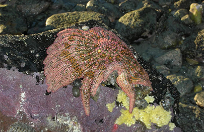
Punta La Gringa is the north end of the beautiful Bahía de los Angeles (Bay of the Angels). It is a popular camping, fishing, and shell viewing area. Starfish and other seashell varieties may be seen and photographed, but not removed, per national law.
The name La Gringa is a bit of a mystery and dates back at least sixty years. Baja adventurist and author Graham Mackintosh gives a hint in his wonderful 1988 book, Into a Desert Place. The story is that a beautiful American widow once lived there on the beach. Local fishermen named the area for her. She was the “gringa” of the bahía.
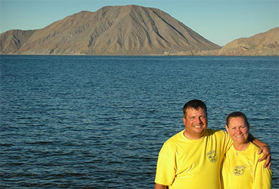
Both sand and gravel stone beaches found at La Gringa, and the sheltered bay makes it an ideal launch site for fishing boats and an anchorage. On the gulf shore to the east and outside the bay is a view to Smith Island (Isla Coronado), famous for the volcano on the north end. Starfish and other shells abound at La Gringa and the smooth stones make for excellent water-skipping as one gazes over to the volcano island. A good story about the area is in Michael Humfreville’s 2006 book, In the Shadow of the Volcano.

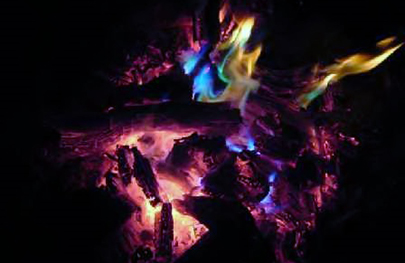
Recently, the seven-mile-long road north from the town of Bahía de los Angeles to La Gringa was paved. Beyond several roads lead to the coast, over hills, and one goes another seven miles to an abandoned copper mine on El Toro mountain. La Gringa was the shipping port for the copper ore from El Toro. Some ore was left at La Gringa, having never been shipped out. Collectors have removed most of the green rocks but a trip to the mine will provide better selections. When a chunk of copper ore is tossed into a campfire, the results are highly colorful flames from the copper oxide burning. One Baja Nomad friend has named the ore, “Magic Rocks” for the colorful effect. However, never burn copper indoors as the fumes are not healthy!
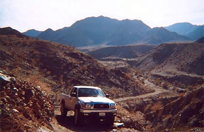
The road to the mine turns left off the road through La Gringa and heads north. In a mile, take the left branch and travel six more miles going west then again north. A four-wheel drive vehicle is advised. The road ends at the base of one copper dig, and the road down into the arroyo by the mine soon ends and passage beyond is by foot only. It is reported to be an hour hike for the 2.6 miles down to the beach from here. This was reported in Jim Hunter’s excellent 1977 guide, Offbeat Baja.

Another foot trail leads east from the switchback below the mine. It travels along a valley then up to a mesa and continues eastward to the El Toro town site and mine center, one mile away. About a dozen years ago several of us hiked this trail in hopes of finding the town ruins. We lacked good directions and the trail vanished on the mesa.
Today, we have satellite imagery to see most anywhere in the world and it is especially useful in planning Baja explorations. Once on the mesa, head east and maybe you will have some success in finding the ghost town. From above, several small building outlines, trails, and mine sites are visible there.
Researching the history, we learn the mine was established by the Gulf Copper Company, incorporated in 1909 with headquarters in Phoenix and an office in San Diego. A gravity aerial tram was to be built to bring the ore down the mountain to the harbor at La Gringa. The mine covered about 100 acres. Tunnels were estimated to be a total of 1,363 feet with 600 feet to the sulphide zone. A smelter was to be developed at the La Gringa harbor to extract sulfur and iron on site. The vein width was estimated to be from 5 to 42 feet of copper ore coming from Melconite and Chalcocite.

Road log and GPS data:
0.0 Road to north at La Gringa: 29º02.490’, -113º32.800’ elev. 8’
1.0 Left at fork in road: 29º03.210’, -113º33.200’ elev. 135’
7.0 Copper Mine, end of road: 29º05.870’, -113º35.820’ elev. 840’
El Toro Ghost Town: 29º05.350’, -113º35.220’ elev. 1,185’
About David
David Kier is a veteran Baja traveler, author of 'Baja California - Land Of Missions' and co-author of 'The Old Missions of Baja and Alta California 1697-1834'. Visit the Old Missions website.