 |  |
Article and photos by David Kier
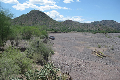
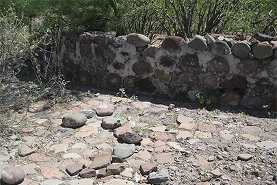
The mission-era ruins of La Magdalena have been one of the many historic mysteries of Baja California, dating back to the 1700’s. The ruins would seem to be a mission farm or visiting station (‘visita’) located at the end of a long canal coming from an oasis valley and ending at a reservoir (or ‘pila’). The buildings were constructed of natural stone and scattered about some 300 feet east of the pila. The El Camino Real (mission road) between the Mulegé and Guadalupe missions goes through La Magdalena, some 15 miles north from Mulegé.
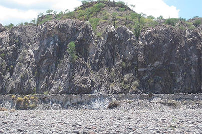
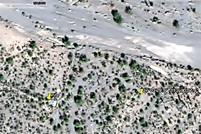
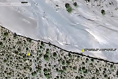
After my first visit to La Magdalena in 2009, satellite imagery has shown the arroyo that was near the site had enlarged and consumed the site, except for the nearby pila. The Baja missions and visitas are vanishing from both human and natural events.
Very little is known about La Magdalena other than it was considered as a new location for the Mulegé mission after the 1770 floods destroyed fields. Baja history author Dave Werschkul (‘Saints and Demons in a Desert Wilderness’, 2003) believes the site dates back to 1708, three years after the mission at Mulegé was established.
In an 1861 report by Sebastian Viosca, La Magdalena is described as being some 5 leagues north of Mulegé. Viosca writes that it was an abolished Jesuit mission, near a place called Rondin. It featured an aqueduct built of stone and mortar that brought water from miles to the west. Viosca said this mission and reservoir furnished grains and fruit to many other missions.
Arthur North (‘Camp and Camino in Lower California’ 1910) camped here in 1906 and assumed this ‘Magdalena’ was the proposed Mission Santa María Magdalena, (which is shown much further north on a 1757 Jesuit map). Many maps and books have since called this site near Mulegé by the name ‘Santa María Magdalena’.
In July, 2015, I returned to the mysterious site to see what was left of the ruins along the widened riverbed. The pila was untouched, now just over 100 feet from the riverbed’s edge. I did find some old wall remains next to the now abandoned road that we traveled on in 2009. This was 300 feet east of the pila, at the edge of the new cliff that is the edge of the riverbed. The large stone blocks and large stone room ruins we saw in 2009 are all gone (Click here to read the story from 2009).
Perhaps if more time was spent searching the surrounding desert, more ruins might be discovered? The location remains a mystery as to why it was out here in the desert in the first place. Why the long canal? Why not just put the farm in the oasis valley where the village of San José de Magdalena is now? That is where the water comes from, after all.
It's definitely time to visit the mission sites and other historic wonders of Baja California before they become only memories saved on photographs!
Getting there
A four wheel drive vehicle is definitely recommended! Between Km. 162 & 163, just north of the series of bridges, turn west off of Highway One. (0.4 mile south of Km. 163, if southbound). Some of this dirt road was used recently for an off road race indicated by many race arrow signs.
About David
David Kier is a veteran Baja traveler and the co-author of 'The Old Missions of Baja and Alta California 1697-1834. Visit The Old Missions website.

Convenient, great website, prices are reasonable.

Only place to get insurance 👍

We drove to Puerto Penasco MX., had an amazing time, great food and nice people, stay at Bella...